The open sky of India,
one coordinate at a time.
A whole-sky view for people, and shared infrastructure for anyone building on top of it.
Why mugilu
For years, people across India have made the sky legible one piece at a time: a map of one city's air, a thread about a heatwave, a chart of last year's monsoon. Brilliant work, but scattered, and easy to lose by the next season.
Sathya Sankaran wanted to stop starting from scratch each time: to pull the whole sky together into one view, every hazard over any point in India, and then hand that out as infrastructure, so the next map, story or alert doesn't have to begin from nothing.
That is mugilu.
mugilu is the Kannada word for the open sky.
For people
Type a place. See what the sky is doing to you right now: air, heat (and how survivable it really is), rain, sun and dust, alongside any official warning over that spot. Then one plain line, the single worst thing for you, whether you have asthma, work outdoors, or are minding a child or an older parent. No sign-up, no jargon.
Build on it
mugilu is meant to be built on, not just looked at. Every reading is also open, machine-readable data, so you can put the whole sky behind your own map, story, dashboard or alert, and spend your time on the part that matters: the telling, and the action.
- For AI agents: an MCP server at /mcp (tools for conditions, place search, nearest stations, warnings and the national picture; plus resources and prompts). Listed in llms.txt.
- For developers: a documented OpenAPI spec, and every reading as JSON or Markdown.
- Embed it: a live card in one line of HTML (/embed/{lat},{lon}), or a snapshot image.
- Put it on a screen: a self-refreshing wall display or kiosk for a clinic, school or lobby, set up at /display.
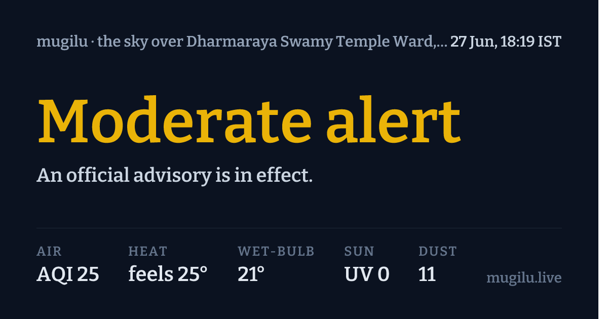
Add ?ref=your-app to any API or embed URL to identify your app (aggregate, domain-level). It's all free and keyless.
Where it comes from
mugilu owns no sensors and runs no forecasts. It stands on others' work and credits them: CPCB and OpenAQ for air, Open-Meteo for weather, NDMA / IMD (via SACHET) for warnings, and bharatlas for the map of India. The code is open under the MIT licence; the data keeps each source's own terms.
Why it's free
The sky over you is a commons. Knowing it shouldn't cost money or sit locked inside someone's app. mugilu is non-commercial, for good, the third in a small set of public tools alongside bharatlas and mdshare.
Common questions
Is it safe to go outside right now?
mugilu names the single worst hazard over your exact location and says plainly what to do, weighted for who you are: asthma, older adults, children, outdoor workers, or a heart condition. It is informational, not medical or safety advice; for official warnings, consult NDMA and IMD.
What is wet-bulb temperature, and why does mugilu show it?
Wet-bulb is the temperature a wet thermometer settles at: it folds heat and humidity into the one number that decides whether your body can still cool itself. Above about 32°C wet-bulb, even resting in shade turns dangerous. Ordinary feels-like numbers hide this, so mugilu surfaces it.
Where does mugilu's data come from?
Air from CPCB, Airnet (CSTEP) and Aurassure via the Open Air Quality broker and OpenAQ; weather, heat, UV and dust from Open-Meteo; official warnings from NDMA and IMD via SACHET; geography from bharatlas. Each source keeps its own licence, and mugilu credits all of them.
Is mugilu free?
Yes. It is free, open source (MIT) and non-commercial, with no sign-up. Every reading is also available as JSON, Markdown, an embeddable card, an OpenAPI spec, and an MCP server for AI agents.
How current are the readings?
Air refreshes hourly, the national heat, rain, UV and dust grid every few hours, and official warnings hourly. Every reading is timestamped with how long ago it was measured.

Built by urbanmorph, led by Sathya Sankaran.
Source on GitHub, drop a star if it's usefulInformational only, not for medical, emergency, or safety-critical decisions. For official warnings, consult NDMA and IMD.